Standard Data Platform for Autonomous Agriculture
The world's first interactive planning software for precision and autonomous agriculture.
Project Overview
Updated November 20, 2024
The Problem
Operating a farm is costly, requiring the purchase of fertilizer, fuel, chemicals, machinery, and other materials. These energy-intensive inputs increase agricultural GHG emissions, which make up 12% of Canada’s total emissions, and lower net farm income. The combination of advancing climate change and declining net farm income is threatening the livelihoods of farmers and our global food supply. To truly move the needle on impacting net farm income and drive the adoption of digital tools, this sector needs a shift from an isolated, siloed view of disparate data layers to a more inclusive, collaborative view of multiple data layers. By providing the tools necessary to evaluate the dependencies between these data layers, this project can enable timely planning of farm operations that will empower smarter, faster and more sustainable food production.
How We Are Solving It
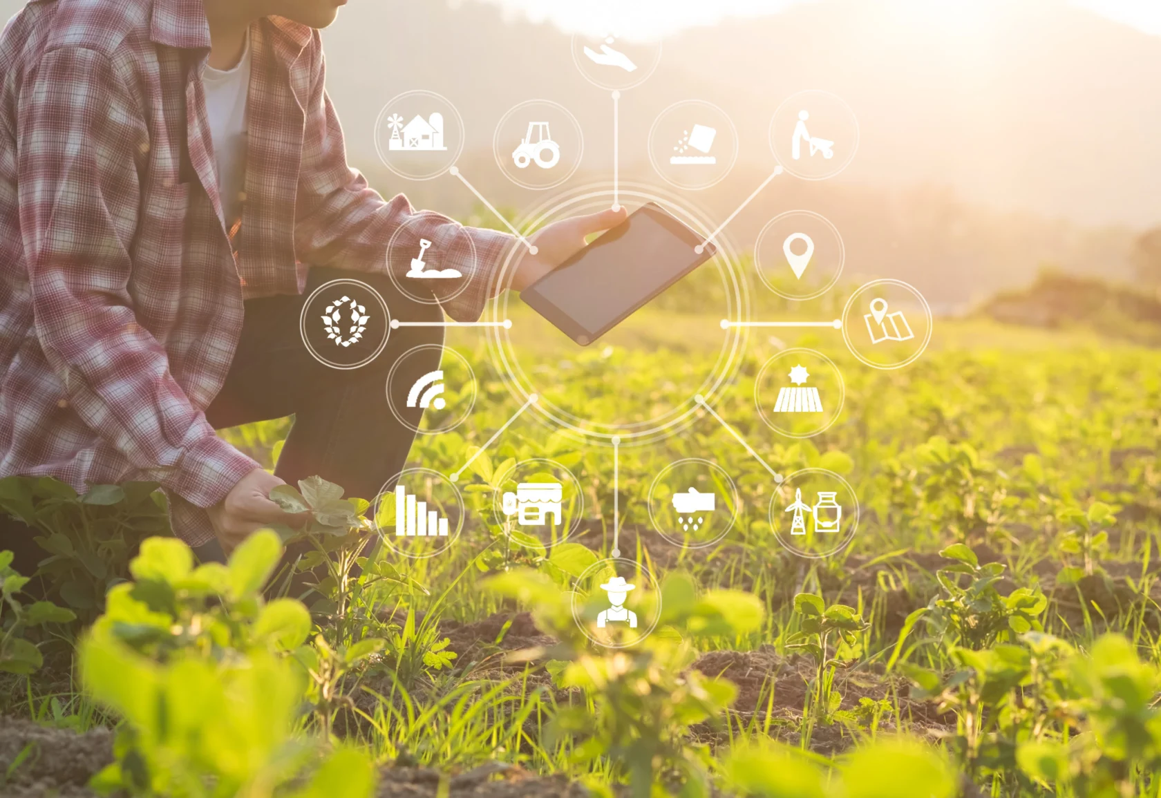
Led by Verge Ag in collaboration with Terramera, i-Opentech, Simon Fraser University, and Quantotech, this project will create the world’s first interactive operational planning platform for autonomous agriculture. The Standard Data Platform for Autonomous Agriculture will integrate three technology components: (1) a data commons framework that fosters innovative data reuse, integration, and visualization to enable characterization of fields, farms, machinery, soil, water, terrain, and weather, (2) a digital twin of the farm by automating the characterization of the fields to fully digitize and define the closed course of the field, and (3) a planning platform that simplifies operations planning to reduce in-field decision making. This platform will provide true performance insights that demonstrate a very clear ROI to users in a concise and easily accessible manner.

The platform will use analytic-ready data and digital tools that combine in-field activities, field terrain, crop and soil characterization and meteorological data to create a digital version of the farm and growing season. This technology will enable farmers to better plan their farming operations and make data-driven decisions based on economic and environmental factors.
These improvements will also impact the atmospheric, terrestrial, and biotic environmental systems associated with crop production, reducing the environmental impact of Canada’s agriculture sector.
The Result
A major outcome of this project was the successful development of a sophisticated data aggregation and processing engine that powers various data models, including field spatial characteristics, water runoff and erosion, optimized machine paths, and benchmarking of year-over-year field operations. Further, data anonymization allows researchers and industry partners to use this data at-scale.
The processed data models are then used to create a digital twin of the farm in Verge Ag’s platform, Launch Pad – helping growers make decisions even when they’re not in the field. The successful characterization of the spatial attributes of fields using commercially and publicly available remote sensing data demonstrated the ability for growers to get accurate spatial information about their fields without having to map each field using ground-based sensors. It also broke the myth of growers needing to provide data to software to derive value; where growers now only need to identify their field on a map for the platform to generate high precision machine routes considering topography and other spatial attributes of the field.
Examples of this demonstration throughout the project also included i-Open Group’s platform, Agrilyze, being used by blueberry farmers in Pitt Meadows, British Columbia to detect scorch virus on their farms through its remote sensing capabilities. This proactive approach saved the grower an estimated $200,000 on a 10-acre section of their field with much quicker detection that traditional methods. Agrilyze was also used to develop a Food Asset Map for the Abbotsford area in British Columbia by utilizing publicly available data to explore the potential of vertical agriculture in creating sustainable, resilient community food systems.
The project also designed and developed an operational planning concept that details data requirements, inputs, and outputs to then build a processing engine that characterizes the growing environment. This was validated for broad acre row crops by working with growers in Alberta, Saskatchewan, and British Columbia. The method of pre-planning, monitoring growth operations and measuring output to create a continuous improvement growing cycle was also deployed within controlled environment agriculture by Quantotech.
As an unanticipated but remarkable outcome of this project, the project’s expanded scope to provide mission-critical applications to Ukrainian farmers was used by a total of 100 Ukrainian growers – totaling over 23,000 fields across 2.6 million acres. This allowed Ukrainian growers to plan and execute field operations safely and efficiently during the planting, growing and harvesting season.
Project Lead
Project Partners

-

"DIGITAL's funding played a crucial role in enabling Verge Ag to make significant strides in our product development and go-to-market strategy, ultimately leading to a successful Series A raise in 2022. With DIGITAL’s co-investment in our project, we were able to de-risk our technology, ensuring its robustness and scalability. This support allowed us to focus on refining our solutions and accelerated our time to market. Additionally, through DIGITAL’s ecosystem, we explored strategic partnerships that provided invaluable resources and expertise, rather than attempting to build everything in-house. These collaborations not only enhanced our product but also positioned us for greater success in the market."
Chief Operating Officer, Verge Ag -
“We are excited to work with a strong consortium of partners with diverse expertise in geospatial technology, data platform development, computer vision, and artificial intelligence. As we enter the fourth agricultural revolution, Verge Ag is poised to prepare the next generation of farmers with hyper-efficient, sustainable and autonomous farming solutions. Our ability to link agronomic planning and production to farm operations planning and productivity is just the start.”
President and CEO, Verge Ag Watch the Launch Pad demo -

“Canadian farmers rely on cutting-edge science and research to sustainably grow their businesses. Scientific breakthroughs have led to new farming technologies and practices, provided farmers with better crop varieties, and helped protect crops and livestock from pests and diseases. This investment in new digital technologies and agri-food data analytics will help make our agricultural industry even stronger while protecting the environment and opening up new market opportunities for our agri-food businesses.”
Minister of Agriculture and Agri-Food, Government of Canada -

"Terramera is thrilled to provide our expertise in Computer Vision and Machine Learning to create the world's first interactive farm operations planning platform as part of this project. This is a vital step towards our goal of transforming how food is grown and the economics of agriculture. We're grateful for the Digital Technology Supercluster's work to support technology to make agriculture more sustainable and position Canada at the forefront of this revolution."
Founder and CEO, Terramera